With a few days randomly booked off work we decided to find a bikepacking trip to go on, and after some consideration we settled on the Olympic Adventure Route loop described by Miles Arbour for Bikepacking.com. We left Vancouver on a Wednesday evening after work and caught a ferry to Swartz Bay then the bus to downtown Victoria. We stayed the night in Victoria so we could catch the Black Ball ferry in the morning.
Day 1
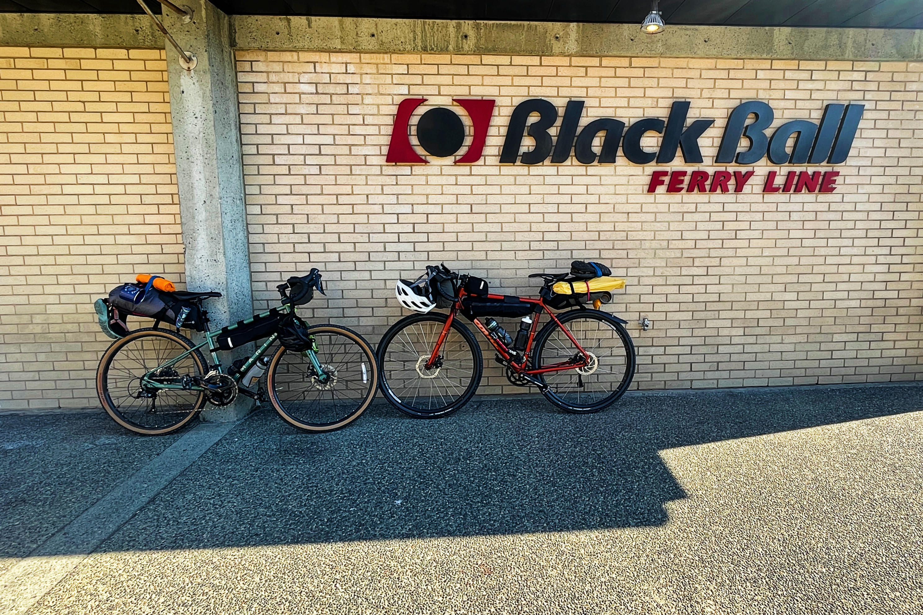
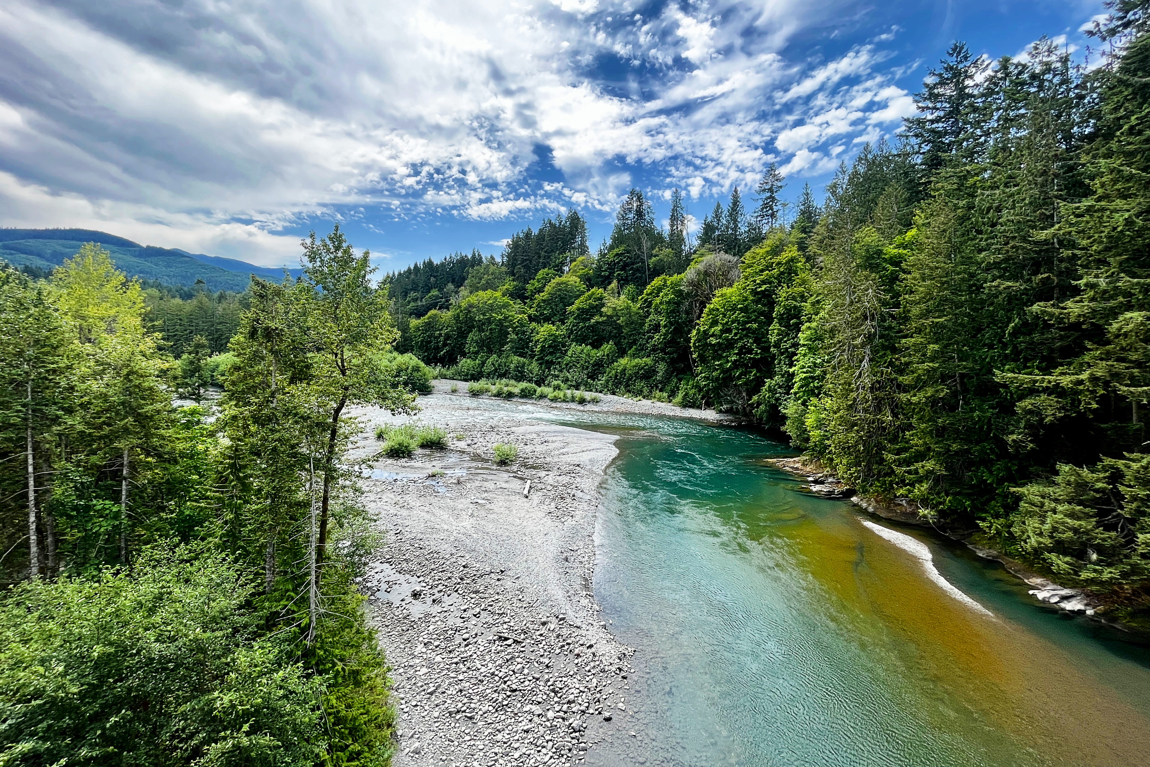
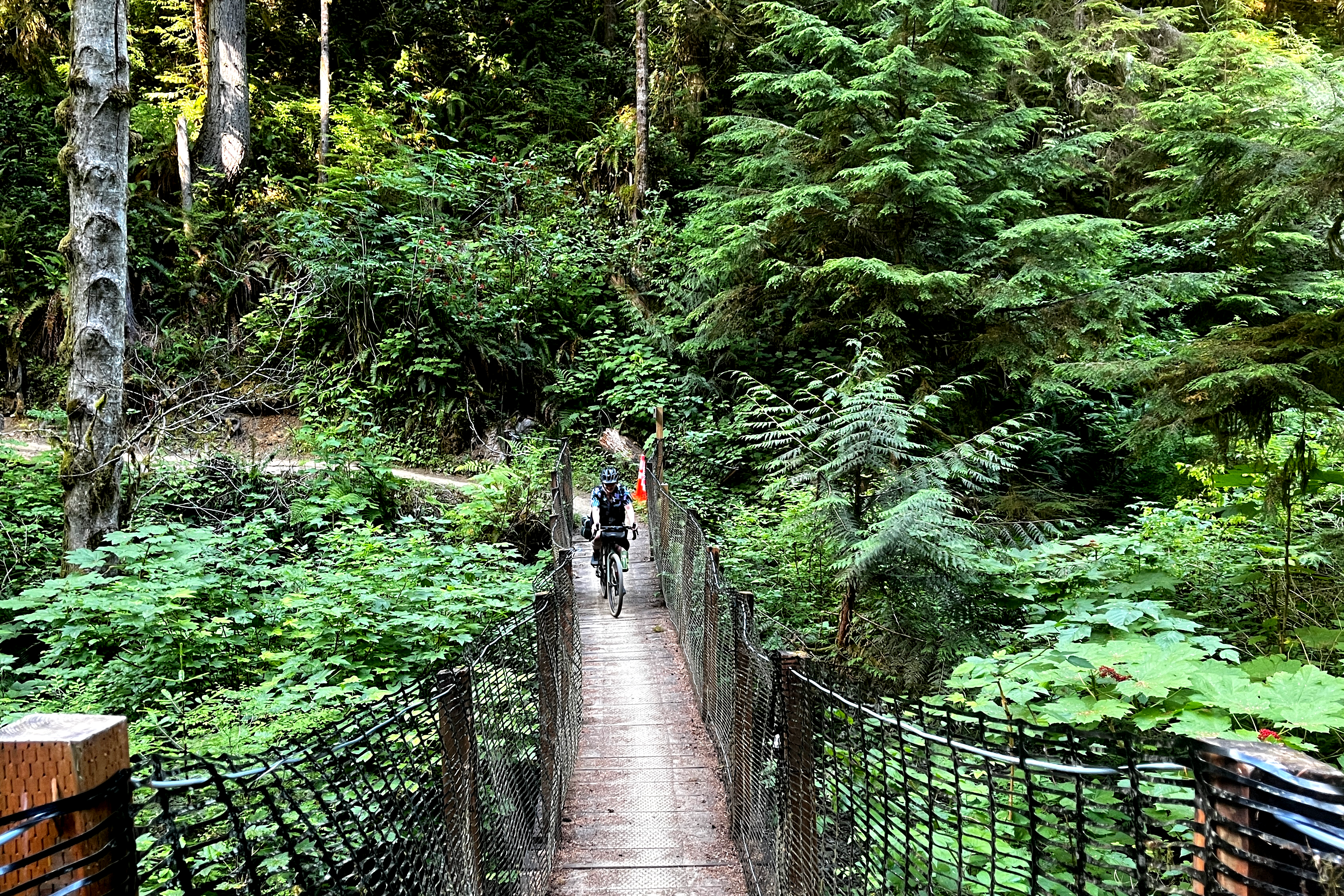
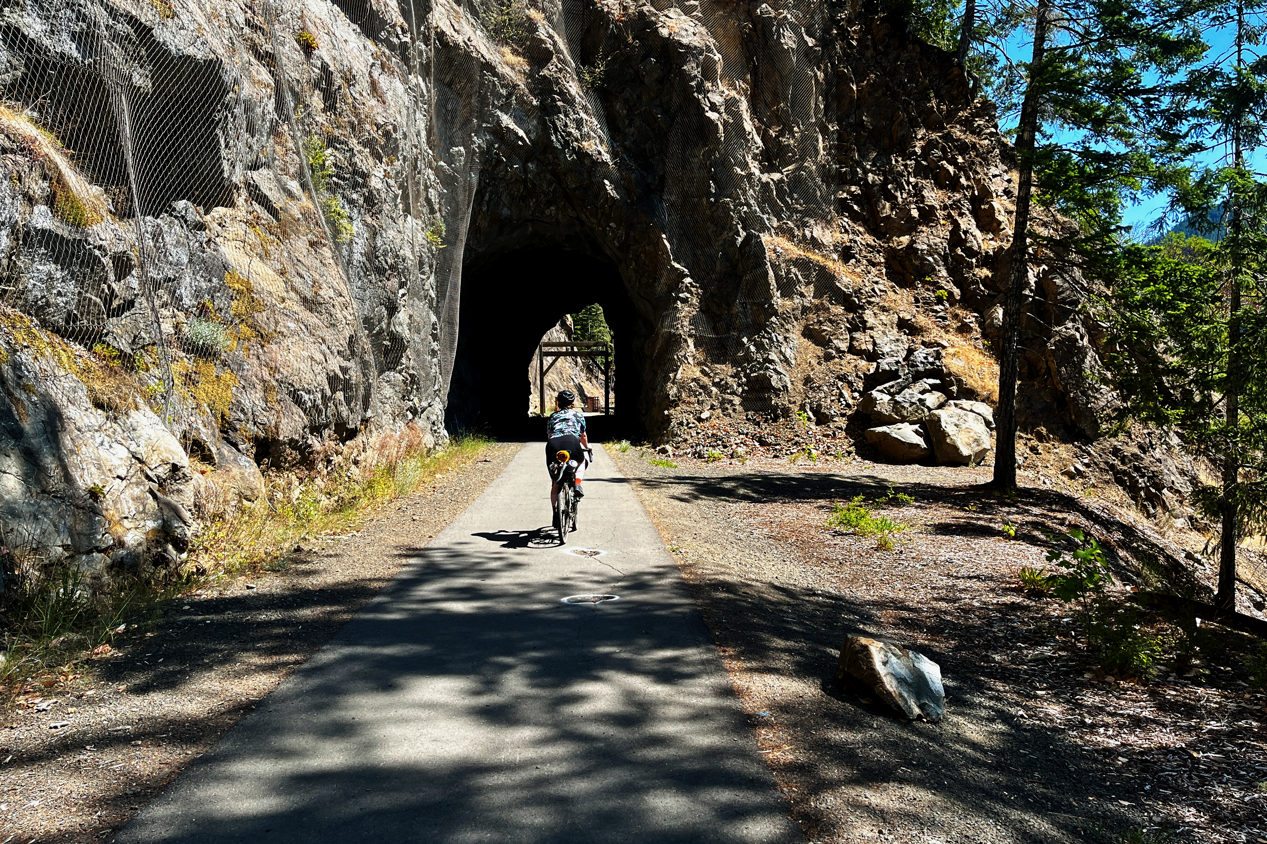
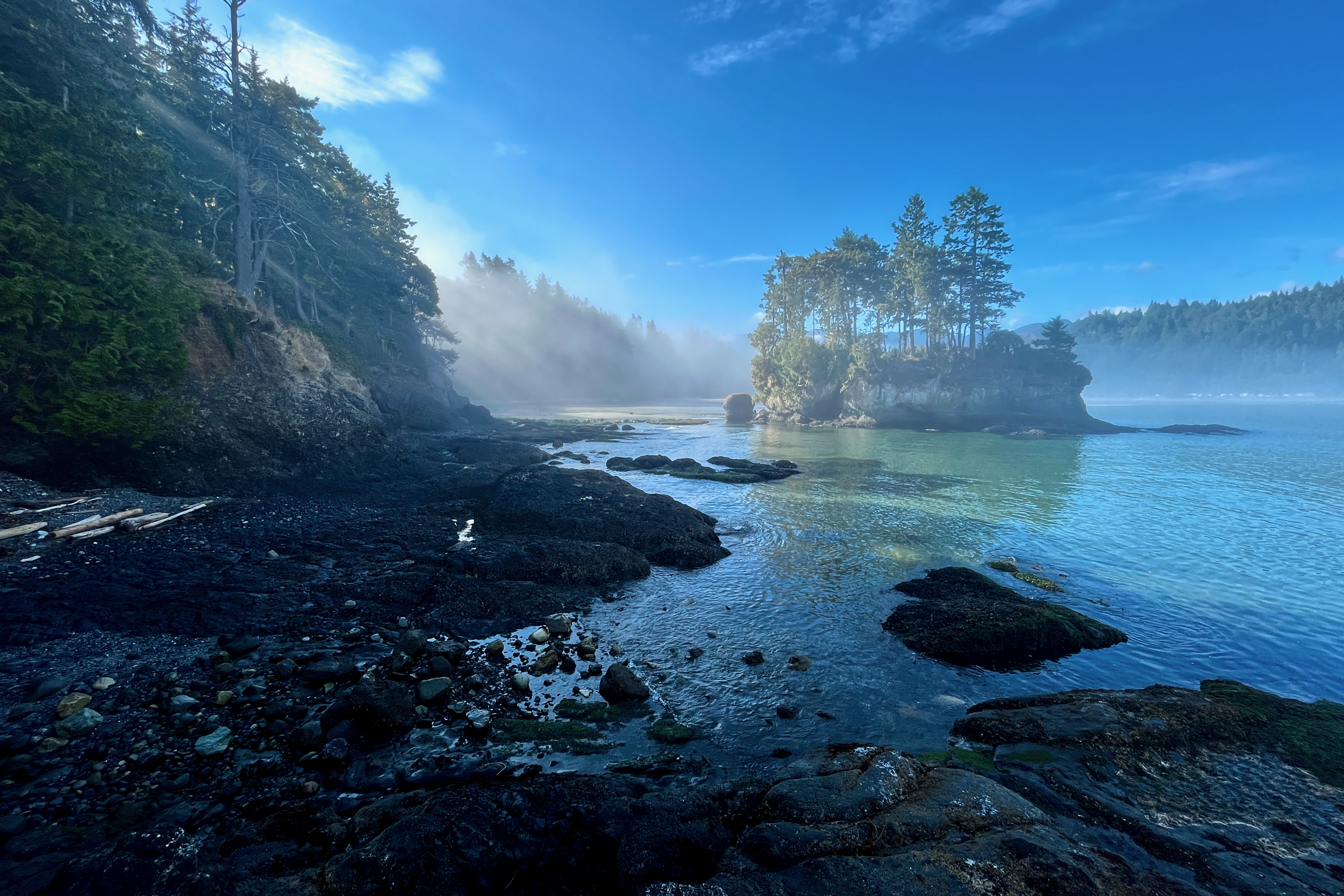
After a good nights rest we got up with the intention to catch the 10.30am Coho ferry. First very important stop though was Habit coffee in Victoria’s Chinatown. Once we were fuelled up we headed for the Black Ball ferry terminal in the inner harbour. Pre-boarding immigration was a breeze even with our Irish passports requiring new permits for entry. The ferry itself is pretty straight forward and has a nice metal bike rack on the open deck (as opposed to BC Ferries where it is on the car deck). Arriving in Port Angeles the route begins immedaitely on the paved section of the Olympic Discovery Trail - this section of the ODT is a mix of quiet residential streets mixed with separated bike lanes for about 12 km all the way up to the Elwha River. The crossing here gave us our first glimpse into the incredible scenery we were going to experience for this trip.
After crossing the river there is about 2.5 km of road and highway riding which, while not the most pleasant experience, was fine. It doesn’t take long before you come across the entrance to the Olympic Adventure Route.
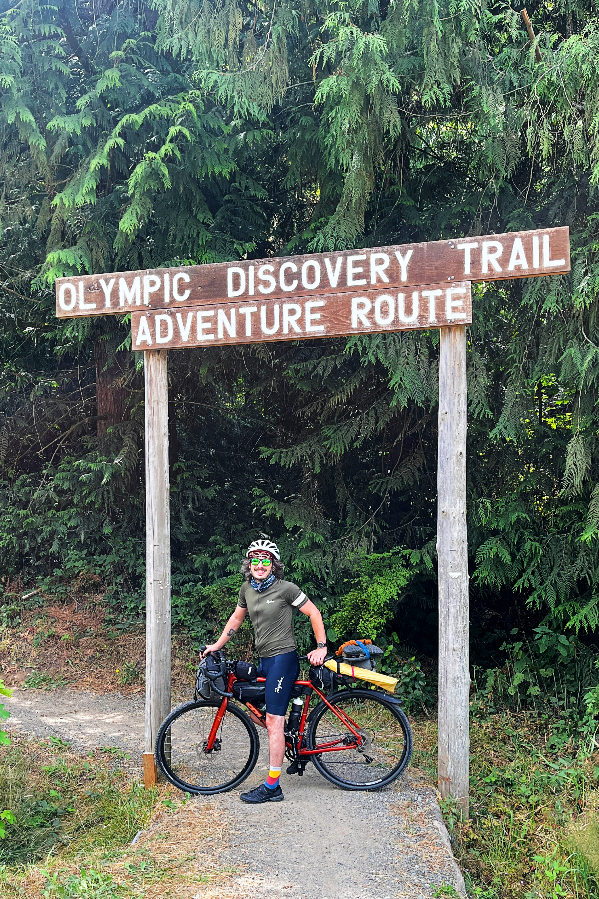
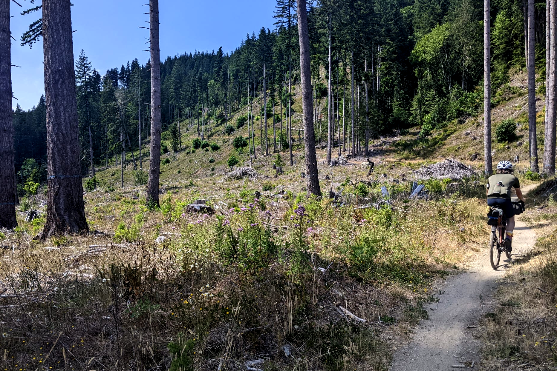
This is where the real adventure begins. What lay ahead was ~30 kms of amazing single track flow, some manageable yet challenging climbs, and vista after vista. The route begins immediately with a climb to get the blood going, and while none of the climbs on this part of the route are particularly technically challenging (we’ll encounter plenty of that on Day 3), they can be a grind at times. With that said - for every climb you will be rewarded with some of the most fun flowy single track you can get away with on a gravel bike. I would say most of it felt like a green, or easy blue, MTB trail rating but with the opportunity to really bomb it if you’re a more comfortable rider. Even with a fully loaded bike we were able to get that awesome nimble feeling while riding the trails here. The first half of this segment has little to no water at the time of year we did it (late July) so make sure you have full bottles before getting onto the trail. The second half has several creek crossings that will let you get a refill (though I would still recommend carrying a water filter for them). The second hard lesson we learned was this part of the route would take us a lot longer than we expected it to. When planning the route out on RideWithGps I measured it as 30 km and figured “Ok, like…2 hours max” but with the terrain and fully loaded bikes that turned into 4.5 hours pretty fast. Unfortunately this meant that we were behind schedule to make it to our planned destination of Fairholme Campground, and when the adventure route intersected with the Olympic Discovery Trail (i.e. Joyce Piedmont Road) we decided to switch onto the pavement for the rest of the day. Pretty quickly we were at the Spruce Tip Rail Road trail and cruising along the shore of Crescent Lake. It was getting close to 7pm at this stage and we were pretty aware that we were pushing it if we wanted to get a campsite that night, so we weren’t able to take advantage of the crystal clear water just yet and powered on to get to Fairholme.
We arrived at Fairholme to some pretty devastating news - the campgrounds were full and they do not have any first come, first serve bike/walk in sites (despite information we had found online beforehand). This was incredibly disheartening and only made worse when we also found out the general store was also closed at this time of the day, meaning we couldn’t even have a beer while we came up with a plan. While Orla tried to track down the camp hosts I spotted a group of other bikepackers and asked them if they knew what the deal was with first come, first serve sites in the grounds - and to my utter amazement it turned out they had booked two sites due to the per person limit of each site, but only needed one for space. They were more than happy for us to take it. Adam - if you ever happen to come across this, honestly yet again I really cannot thank you enough. Now we just had to solve the beer problem. We had some US cash on us, so figured we would walk by a couple of sites and offer a few bucks for two beers to anyone that looked friendly. We ended up with a couple beers each, for which no one would accept our cash - and one family that insisted on taking a photo with me as they presented 4 tall boys of Coors Lite to me as an official gift to Ireland. What started out as a panic, as we tried to figure out what we might do that night, turned out to be a perfect evening thanks entirely to the kindness of strangers.
The lesson, however, is that Fairholme Campground does not keep any first come first serve sites aside - and the general store closes at 7pm in the high season. If you are thinking of doing this route, I’d recommend either getting a reservation or getting the earlier Coho ferry from Victoria so you have plenty of time to arrange other plans if no sites are available when you arrive.
Day 2
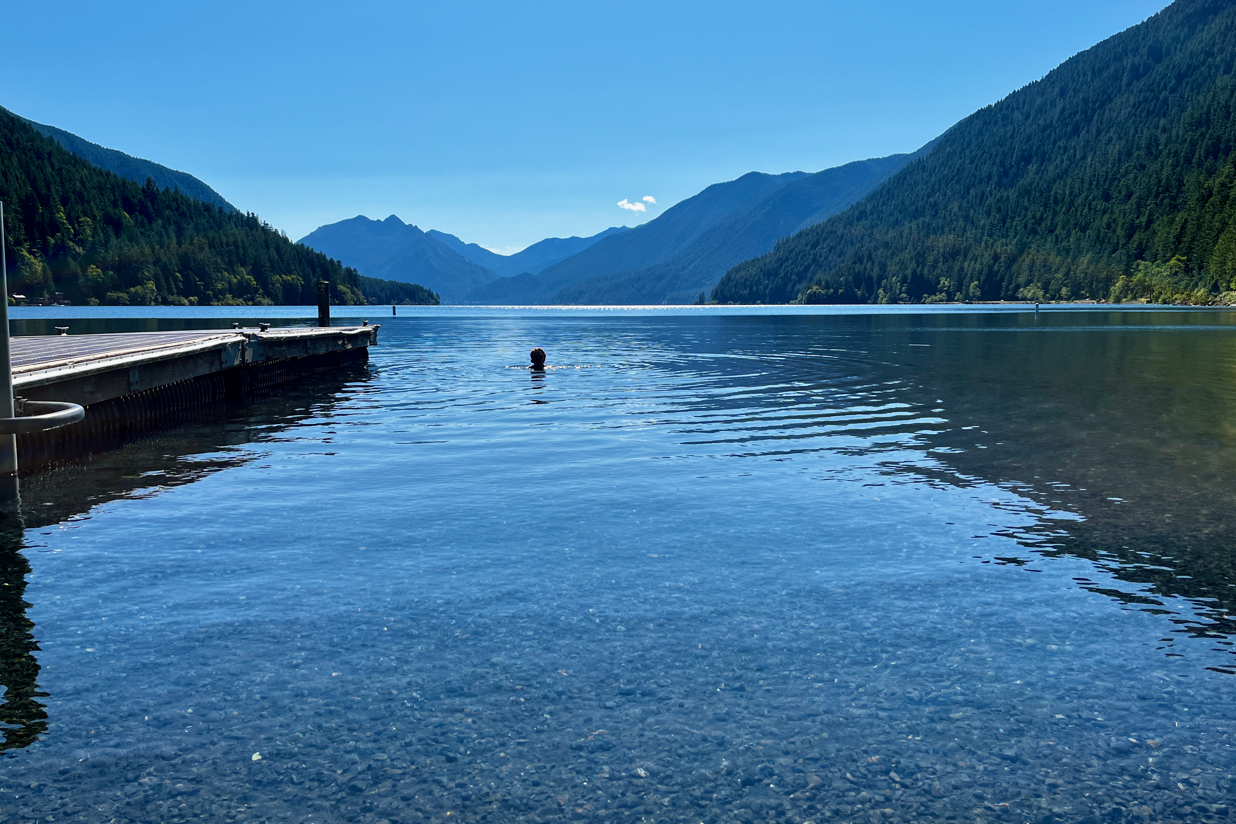
We awoke to a beautiful morning at Crescent Lake and restocked on trail snacks from the now open general store (which has a great beer selection, I was even more annoyed to discover). After this we decided it was time for the lake dip we didn’t have time for the previous day. The water here is absolutely pristine but boy is it cold. I spent about 3 minutes in it, but Orla somehow braved it out for about 15.
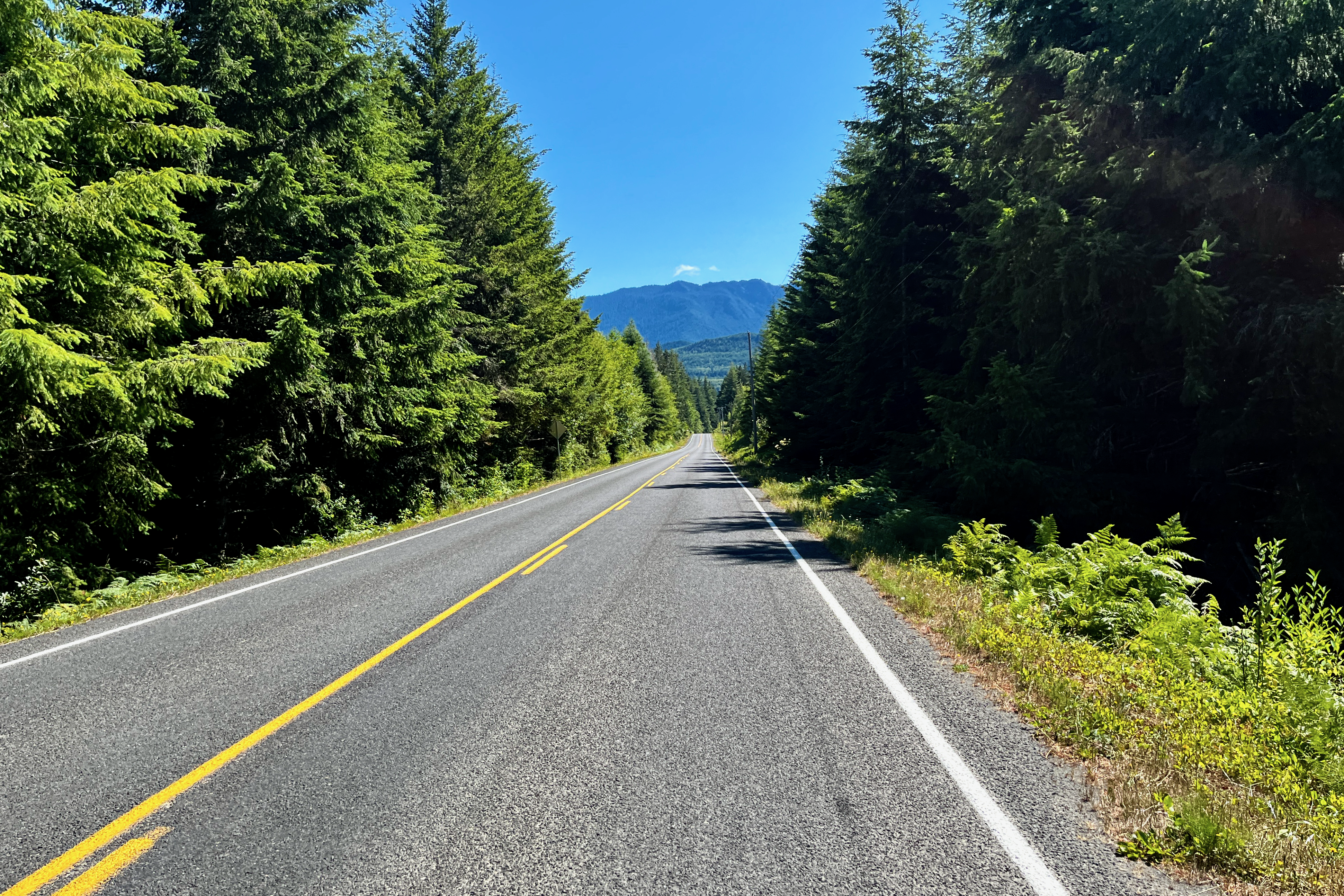
Our plan for today was just to get to the Salt Creek area, and hopefully camp at the Salt Creek Rec Site. This gave us only about 30 km of riding to get done that day, all of which would be on paved roads. This allowed us to have a more chill pace than day 1, and after our swim we packed up our gear and started backtracking on the Spruce Tip RR that we had done the evening previous. We retraced our steps as far as the intersection with the Olympic Adventure Route and continued on the road back downhill toward the coast to highway 112. The riding here wasn’t as spectacular as the previous day, but it was good quality road riding and took us past some beautiful homesteads and farms.
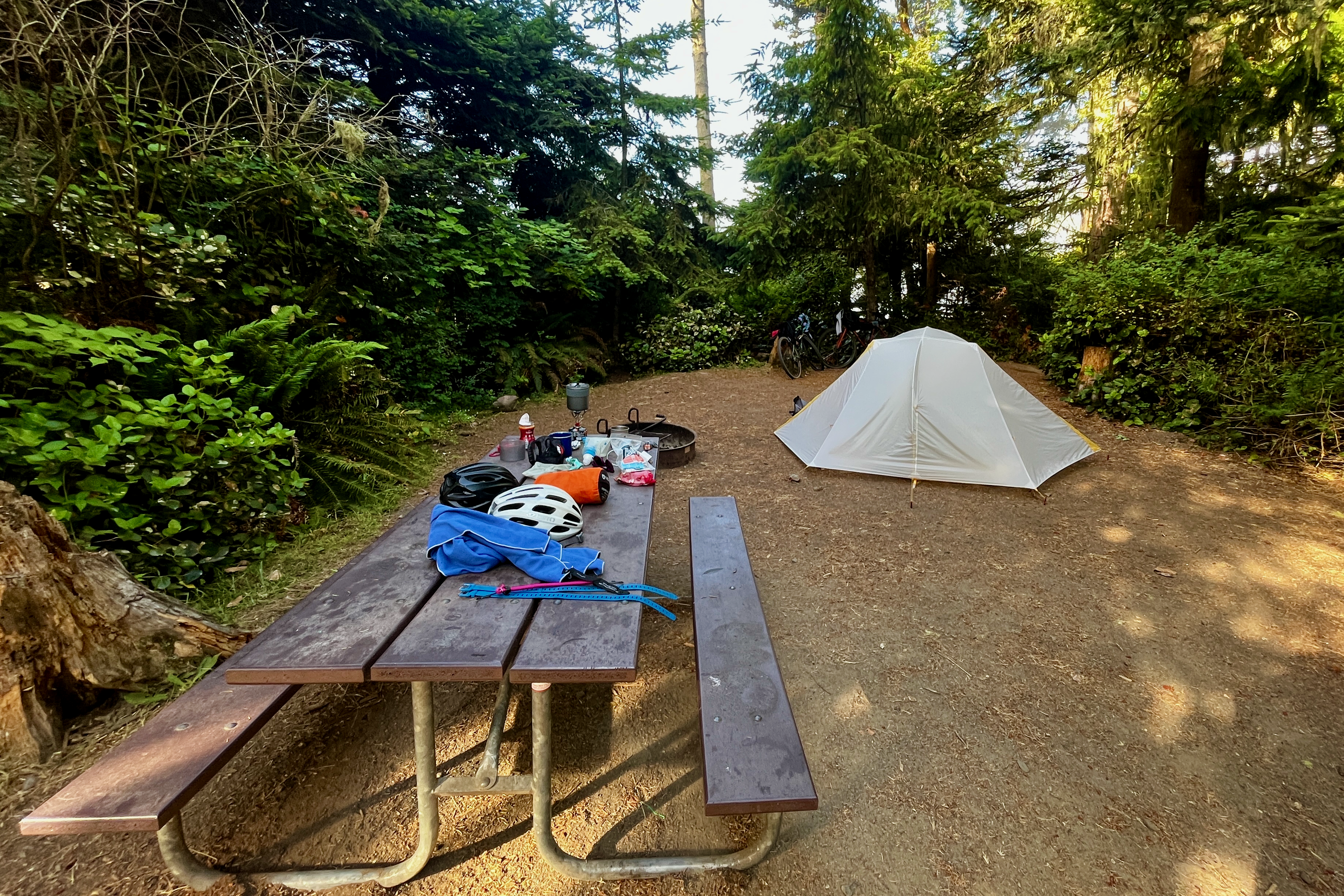
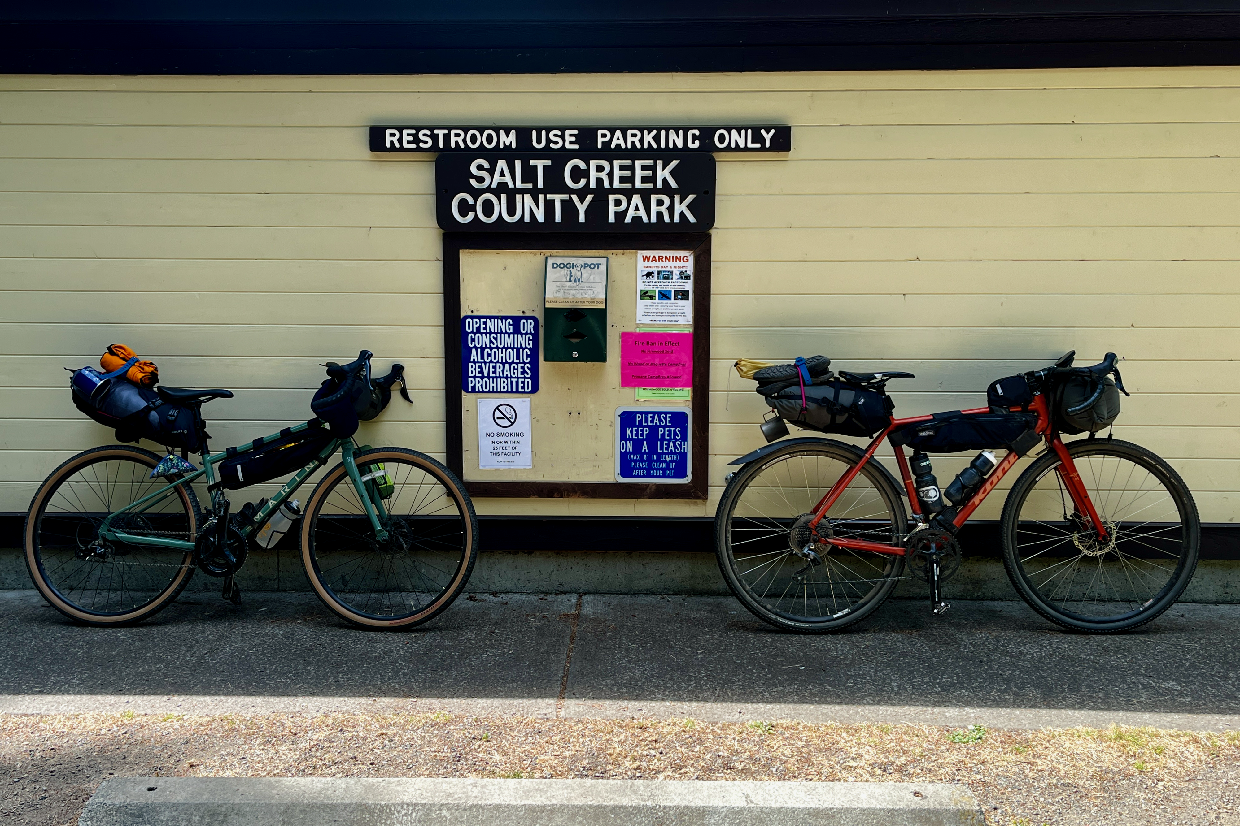
We made it to the intersection of the ODT and highway 112, and decided that rather than stopping at Joyce General Store right away we would keep going all the way to Salt Creek Rec Site and see if we could secure a site for the evening. This brought us past more farmland and more good quality downhill road riding (though we were well aware that we would be climbing back up all of this to Joyce General Store in order to get supplies if we did find a site). Once we made it back to sea level we were greeted by the stunning reveal of Crescent Bay - I didn’t get a picture of this but just picture a very stereotypical, picturesque PNW beach in the Sun. We rode past a private RV park that had nice looking tent sites and made a mental note that we could come back here if the Rec Site was full. To our delight, the Salt Creek Rec Site keeps about 25 sites free for first come, first serve and they are in a pretty stunning area. We grabbed a site, paid our fee of $30, and set up our tent. Not wanting to wait too long we got back on the bikes and started the trip back to Joyce General Store. It is hard to describe the experience of shopping in Joyce General Store but it is an amazing little spot - a US mail office, a hardware store, a gift shop, a grocery store, and a liquor store all rolled into one and seems to cater to an equal amount of tourists and colorful locals (I mean that in the nicest way possible, everyone there had a personality). Yet again, we stocked up on provisions and headed back to our home for the night. And in case anyone is curious - you can comfortably fit 12 355ml cans of beer in an Alpkit 12 liter saddle pack dry bag. Just in case you were wondering.
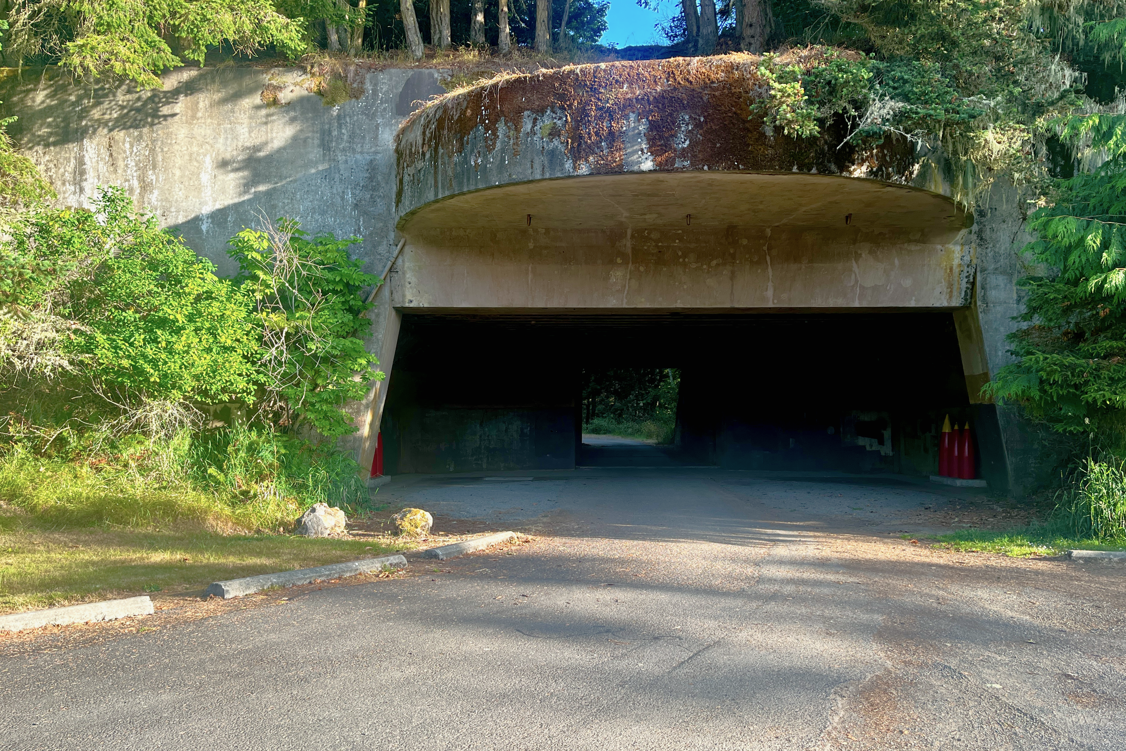
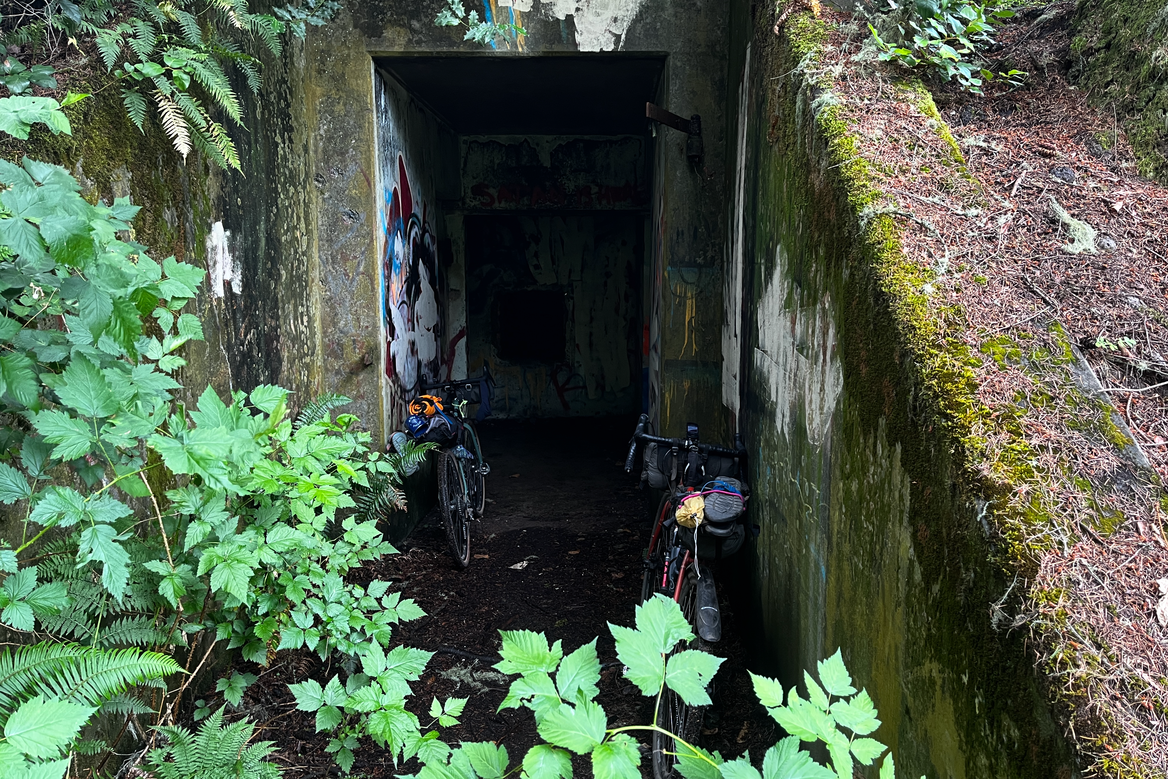
On our descent back we stopped at the main Crescent Beach area and took in the view for a bit before climbing the few hundred meters back to the campsite area. Once back at camp we ditched our bikes and bibs and started exploring the Salt Creek bunkers. These are old WW2 bunkers that were part of the Pacific Defense system. As the evening went on we strolled down to a rocky outcrop on the edge of the park called Tongue Point - this gave us front row to a spectacular sunset and was a fitting way to finish off a much more chill day of adventuring.
Day 3
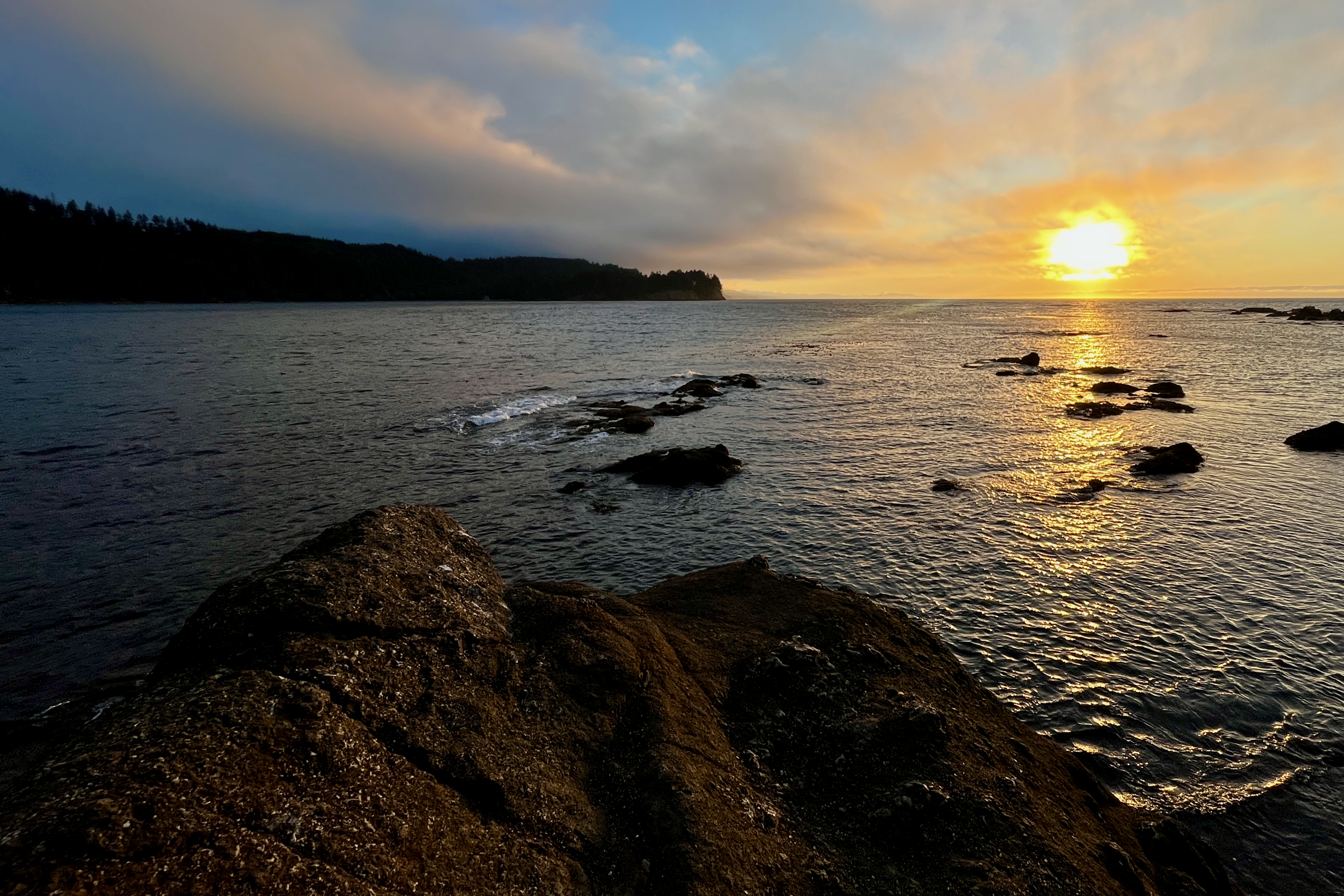
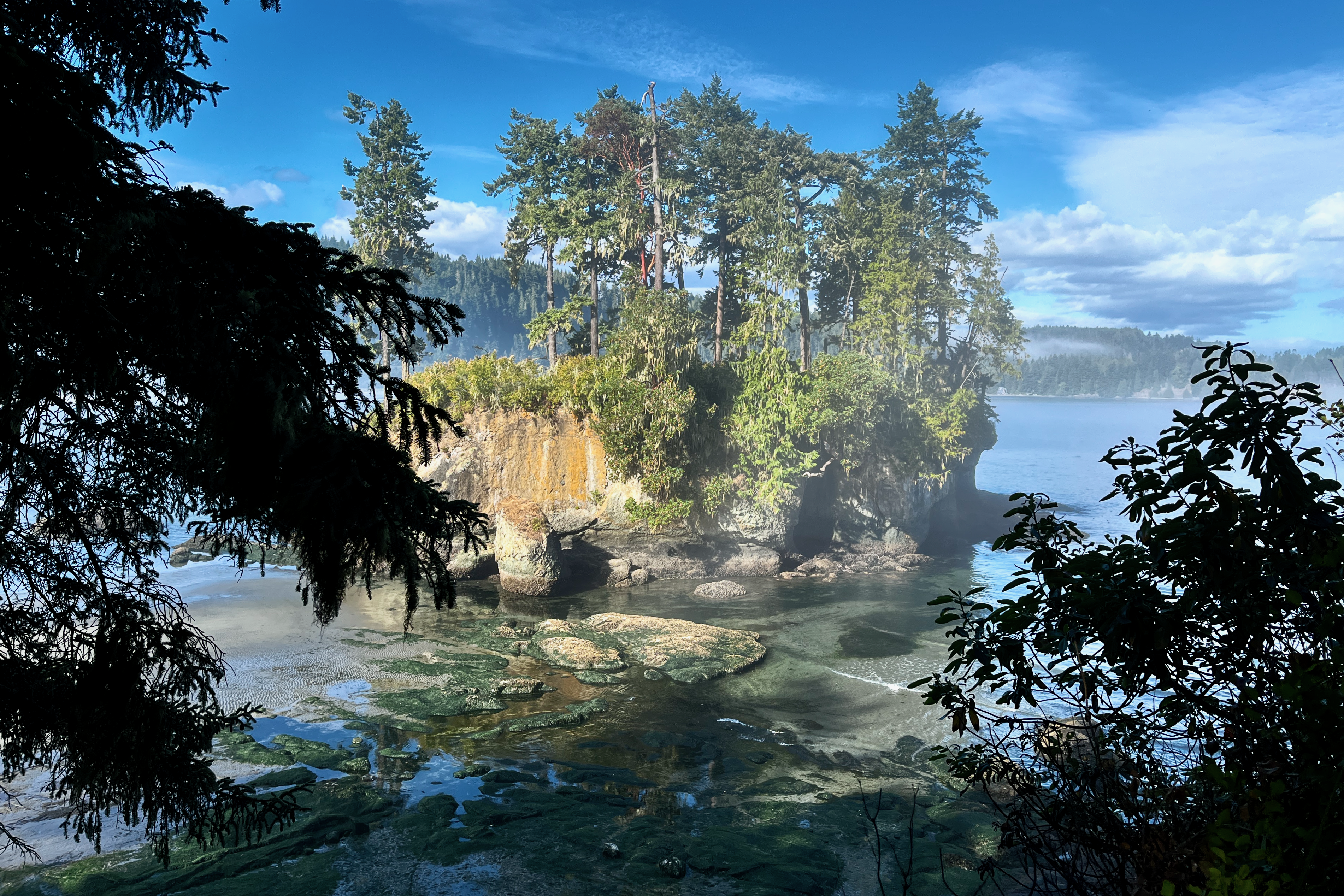
We woke up on day 3 to more PNW atmosphere as the fog rolled in from the ocean across our campsite, we took a few minutes to make coffee and strolled back down to Tongue Point to check it out. The view that morning was, frankly, stunning. We sat on the rocks and tried our best to enjoy our Folgers instant coffee (it sucks, to no surprise). We took some time looking at the rock pools and trying to spot hermit crabs, clams, and anemones. We figured we had lots of time today to make it back to the ferry at 5.15pm so we weren’t in a rush (foreshadowing, this was a mistake).
Again taking our time we had an early lunch and left our camp by 11am. We knew we had some difficult climbing to do, but we only had to cover 30 km and had 6 hours to do so. The day started out with a 1.7 km climb up Bunker Ridge Trail. This was a technical and often steep climb and was the only point on the trip where I wished for my mountain bike instead of my gravel bike. To make up for it we were treated to a lush forest and stunning views out over the Strait of Juan De Fuca. Unfortunately, about 80% of the way up that climb the chain on Orla’s bike snapped. At first this seemed like not that a big deal, as it happened to snap just two links away from the quicklink. However after spending close to 45 minutes attempting to undo the quicklink on the side of the trail we realised we couldn’t make it happen (YouTube made it seem trivial with some USB cable or a piece of paracord). At this point we figured time was going to become a concern so we decided in the moment that the best course of action was to freewheel back down to Salt Creek and try find another set of bikepackers with a quicklink - or hitch a lift to Port Angeles from someone with a bike rack. It was a bittersweet moment as we considered the possibility we would not be able to finish off our entire loop on our bikes. Returning to camp I tried to find another group of bikepackers but to no avail. Taking another look at the chain, I figured I could probably try to make it work by breaking the chain and pushing the pin only 3/4 of the way, then reversing the chain breaker and attempting to push it back into the new link. This turned out to work more or less perfectly, and even though the chain was now too short to engage the lowest gear it put us back in action. Orla would ask me if we could have done this on the side of the trail in the first place to which I had no good defence…
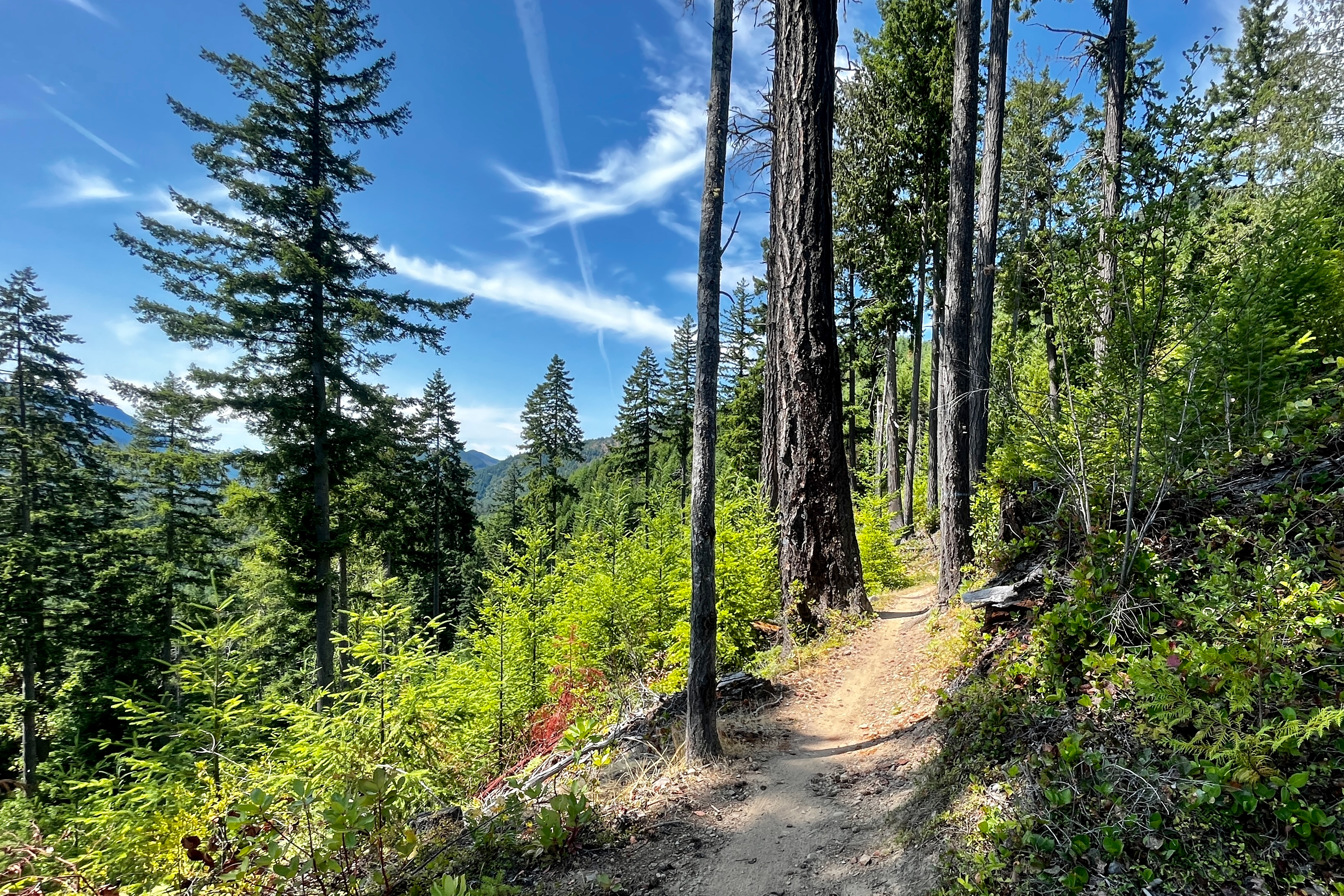
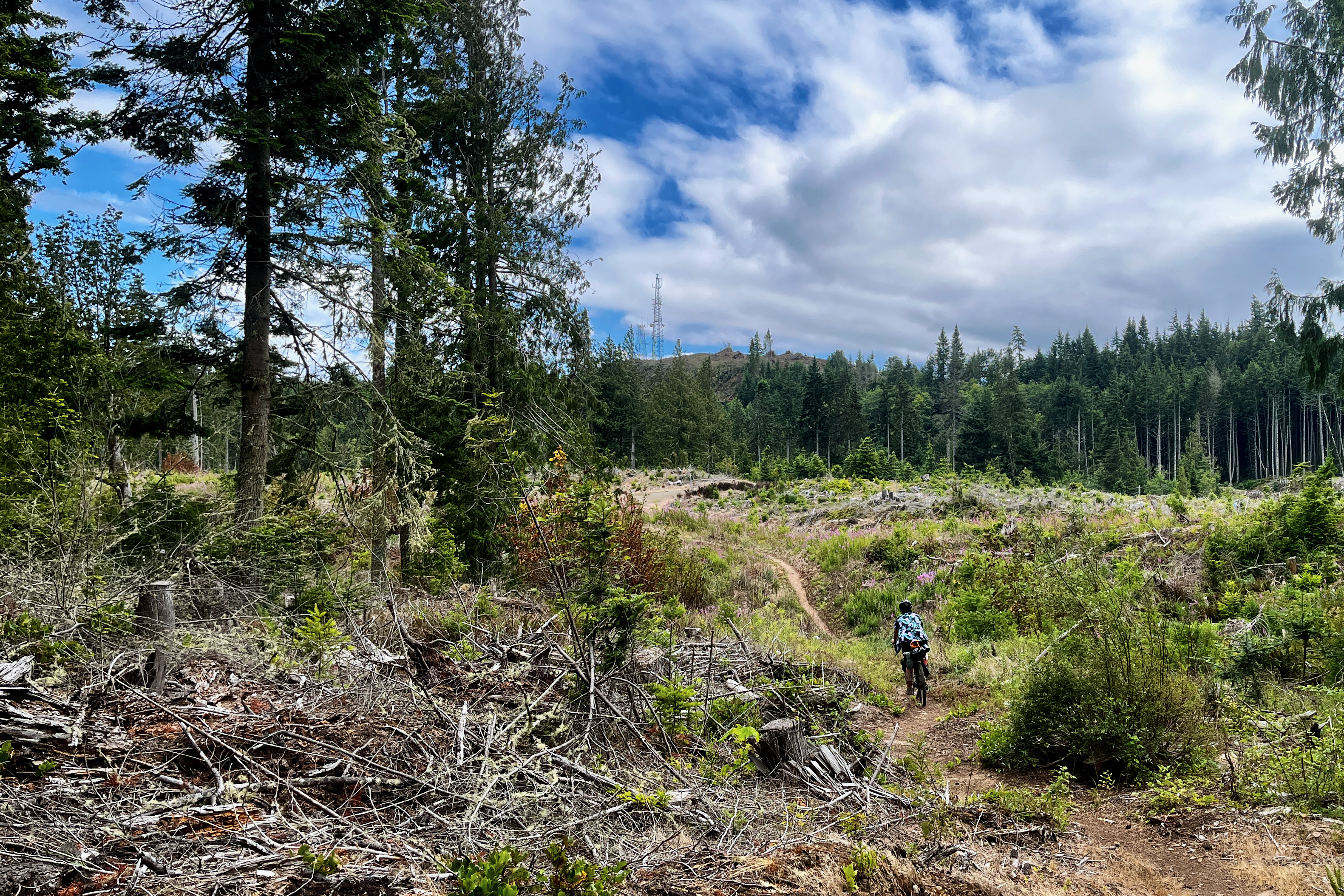
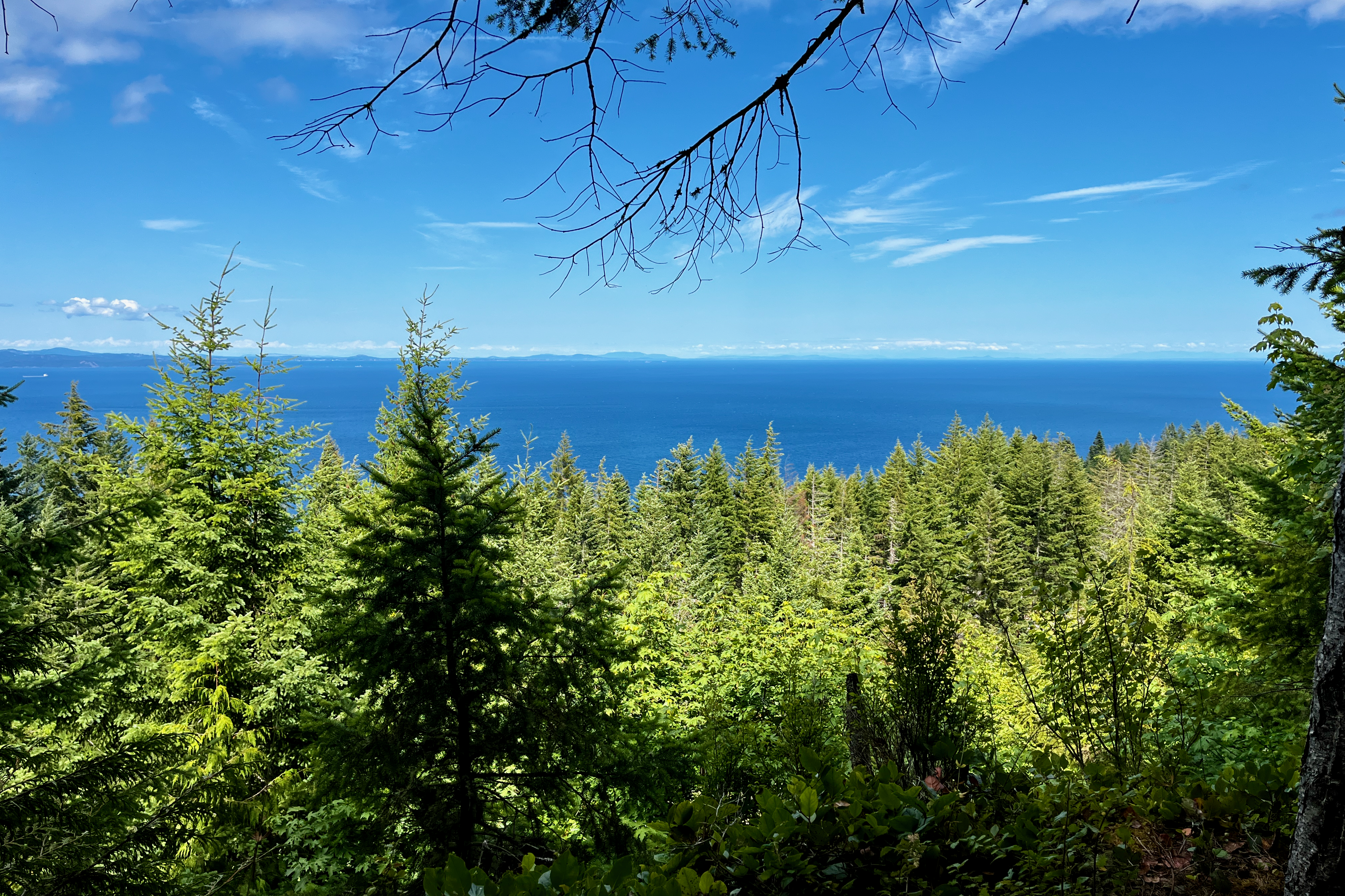
The downside of being back in action was that we had to do the Bunker Ridge climb all over again. We had some practice in this time though, and managed to clear some of the more technical sections on the second attempt. A couple hundred metres from the peak we discovered the trails namesake in the form of another WW2 bunker. We parked our bikes for a minute and donned our head torches but didn’t hang around too long once we started getting very horror movie vibes. A quick push to the summit and all of a sudden the landscape just opened up. On our left was the stunning view over the sea all the way to Vancouver Island, ahead of us was alpine-esque single track as far as we could see. The trail here was rockier than the Adventure Route, but was still very enjoyable on our fully loaded gravel bikes - and of course still had plenty of flow. After a few kilometres of single track it was back onto a well graded FSR and finally back to pavement.
The final stretch was a few highway miles and then some backtracking our first 12 km from Day 1 back to the ferry. As alluded to, our leisurely start to the day hadn’t accounted for breaking a chain and riding the biggest hill of the day twice. We were about 1okm away from Port Angeles with 30 minutes to the ferry’s departure - not a huge issue but definitely made us pick up the pace for the last little bit of the trip. Thankfully we made it right on time for boarding and started back to Victoria. We decided not to try to link up to the BC Ferry to Tsawassen that evening and instead stay in Victoria to relax, shower, have some food, and grab a drink. A little bit of research suggested the best bike friendly hotel for a reasonable price was the Royal Scot, which happened to be a 30 second ride from the Black Ball terminal. As our research had hinted - they were indeed extremely bike friendly and had no issue with us bringing our dusty bikes to our room, and were courteous and friendly while checking in what must have come across as a very ragged and tired Irishman.
Conclusion
The full route that we did is below - do not use that GPX file as your own guidance unless you want to do Bunker Ridge trail twice.
This is a really incredible route, and I would happily go ride any portion of it again. We are even thinking of just going back in the car to Salt Creek and bringing the bikes to do Bunker Ridge loop again. This entire route was more than comfortable on gravel bikes with 43mm knobby tires, though going fully tubeless would have been nice for some of the climbs. Also - bring a spare quicklink.